Towards a Digital Garden City Nation: Part one
The first part in our look at the role digitization will play in Japan’s greener tomorrow
The government of Japan’s vision for a Digital Garden City Nation is a bold plan to use technology to create a greener country and Unlock is profiling some of the projects at the forefront of this movement. In part two we look at the role technology exports and smart agriculture will play. While below we explain more about the vision for a Digital Garden City Nation and look at the world’s most extensive set of virtual city models.
The new digital age
Japan has big plans for a better tomorrow. The country has taken a giant leap toward a digital future during the pandemic, driven by the popularization of remote work and increased demand for online public services. Seeking to build on this momentum, the government had laid out a bold vision for a Digital Garden City Nation—a roadmap to digitalization for solving rural issues such as depopulation.
The aim is to harness technology to make living and working anywhere in the country more comfortable, convenient, and sustainable. This involves turning the challenges each rural area is facing into a driving force for nationwide growth in a country connected through digital means. Additionally, the hope is that solutions developed in the course of this initiative will increase Japan’s attractiveness as an investment and business destination, further boosting the economy, encouraging innovation, and facilitating the export of Japanese technology—all while reviving the regions.
A wide range of international issues are set to be discussed at May’s G7 Hiroshima Summit and the related 15 ministerial meetings that will be held across Japan. The many facets of the vision for a Digital Garden City Nation, including smart infrastructure and agriculture, are expected to have a major impact on these conversations. In a preview of that agenda, we explore three projects at the forefront of the initiative: the use of 3D city models and smart agriculture, each taking place in a region set to host a G7 ministerial meeting, as well as technology exports for urban development in other Asian countries.
“The aim is to harness technology to make living and working anywhere in the country more comfortable, convenient, and sustainable”
Model cities
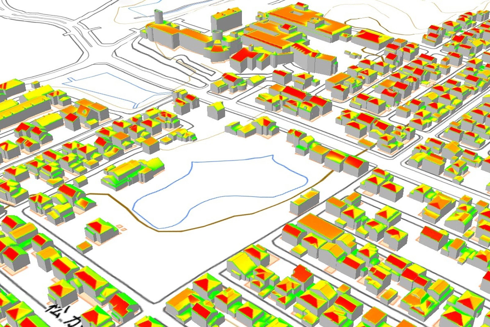 Simulation of solar power generation in Kaga (above), (below left to right) Wakako Jimba, Mayumi Mizobuchi, and Yuya Uchiyama | Asia Air Survey Co., Ministry of Land, Infrastructure, Transport and Tourism; Keisuke Tanigawa
 Japan’s Plateau, the world’s most extensive set of virtual city models, is set to bring urban planning and environmental policy into the digital age. Wakako Jimba, Mayumi Mizobuchi, and Yuya Uchiyama, who are key to the project, explain how 3D maps can help with everything from solar panel placement to making cities more walkable
As Japan steps up efforts to achieve its goal of carbon neutrality by 2050, cities and towns across the country are exploring a wide variety of paths toward a greener future. So far, one popular solution has been to install solar panels on the roofs of buildings, with the aim of covering a significant chunk of local electricity consumption with locally produced power. But knowing where and how to place the panels to achieve optimal results has often proved challenging.
Digital technology may soon solve that dilemma, along with many other problems of environmentally friendly urban planning. In 2020, the Ministry of Land, Infrastructure, Transport and Tourism (MLIT) unveiled Plateau, a project aiming to bring together a vast and growing set of three-dimensional maps and other data into what is now the world’s most extensive open 3D city model. By making use of existing data held by local governments, Plateau has grown quickly and will soon include virtual versions of 130 cities across Japan.
The launch of Plateau, which is based on open data and accessible to anyone, has spawned a flurry of efforts to harness this powerful resource for smarter and more effective policymaking. Backed by the MLIT, some 100 “use-case” projects—initiatives aimed at demonstrating the practical benefits of 3D city models—have been carried out so far by organizations and companies throughout the country.
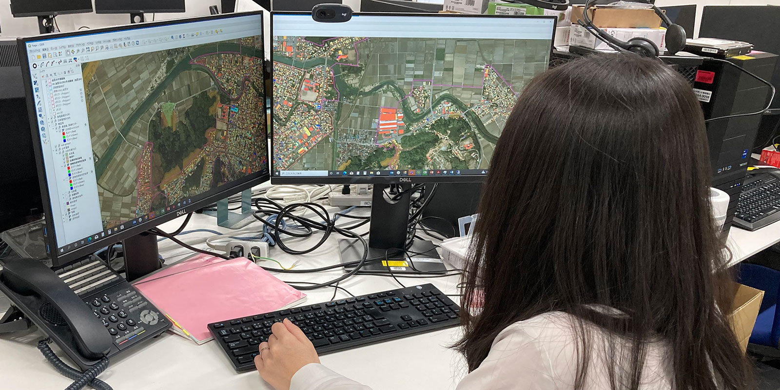 Wakako Jimba demonstrates Plateau’s virtual city models | Asia Air Survey Co.
One highlight initiative explored the prospects for solar power production in Kaga, a city located on the Sea of Japan in Ishikawa prefecture and noted for its embrace of decarbonization-focused urban planning. Plateau’s 3D model of Kaga was used to run a municipality-wide simulation of solar potential by analyzing the number of building roofs in the city capable of hosting solar panels.
Local officials are now working with geospatial survey, consulting, and software firm Asia Air Survey Co. (AAS) to produce even more precise estimates. “We are building software capable of evaluating the potential of solar power generation on a building-by-building level,” says Wakako Jimba, who leads AAS’s development team. “[Using our program] can make local governments’ simulations more accurate, and having the results in 3D form will make them easier to understand for residents when the time comes to ask for permission [to install solar panels].”
 AAS’s Wakako Jimba (l) and Mayumi Mizobuchi (r) | Keisuke Tanigawa
Once development has been completed—MLIT is aiming for a spring 2023 launch—the simulation program will be available for free to anyone interested and applicable to any other location with a 3D city model in place. “Tailoring the software for non-professional use has been challenging,” says Jimba, “but we’ve done our best to lower the hurdles for use as much as possible.”
But the potential of 3D city models in improving urban planning and cutting emissions goes far beyond deciding where to place solar panels. “Plateau being open source allows for a wide range of applications,” says Jimba. Yuya Uchiyama, director of the Plateau project and a deputy director in MLIT’s urban policy division, agrees. “The 3D city models could be used to plan the expansion of sidewalks to make a city more walkable, simulating things like how much of an increase to pedestrian traffic could be expected, or to predict the movement of people after a disaster or accident to draw up evacuation routes that prevent overcrowding and the formation of bottlenecks,” he says. “Some startups have even tried simulating drone deliveries.”
“The 3D city models could be used to plan the expansion of sidewalks to make a city more walkable”
 Plateau project director Yuya Uchiyama | Ministry of Land, Infrastructure, Transport and Tourism
Uchiyama is confident that Plateau’s coverage will keep growing, with 3D models of new municipalities being added at a steady pace. “Engineers and civic tech people, universities, and the private sector, who are the ones developing the solutions, will have ever more data to work with,” he says. And in the future, Plateau-based applications made in Japan could well help cities elsewhere become greener and smarter, too. “Plateau is compatible with CityGML, the international standard for 3D city models,” says Mayumi Mizobuchi, Jimba’s colleague at AAS. “That will be an advantage when the time comes to share our expertise with other countries.”